At 630 miles long the South West Coast Path (SWCP) is Britain's longest national trail. In 2016 I hiked the first 80 miles of the trail from Minehead to Bideford. I was so impressed by the natural beauty of the countryside and the dramatic coastal scenery in this part of England, that I decided to return and continue hiking from where I left off, this time hiking from Westward Ho! in Devon to Padstow in Cornwall. When I arrived in England I first went to Redhill to visit with my friend Dot. We did a bit of sightseeing and then went to The Plough pub to try our luck at Quiz Night. The following day I used my rail pass to travel to Chippenham, where my friend Clive met me and drove me to his home in Luckington. During my two-day visit we did a lot of exploring: First to Westonbirt House and Gardens. Westonbirt is an impressive estate which was once the home of the Holford family, including 19th Cent. tital Robert Holford, a collector of fine art and books. The house is now a private prep school and we were unable to enter because of security reasons, but we spent several hours touring the vast estate and gardens. On the following day Clive and I hiked along the path that follows part of the Sapperton Canal. Built during 1784-1789 it was a 36 mile long Cotswold Canal that connected the River Severn to the River Thames. Along its length there were some long tunnels and when it was built it was the longest canal in Great Britain at the time. Following another path we eventually found a stone making the source of the River Thames. After having a pint at the Tunnel House pub we drove to the nearby town of Cirencester. During the 2nd Cent. it was a Roman town called Corinium Dobunnorum, the 2nd largest town in Roman Britain. There the Romans built a huge amphitheatre capable of holding up to 8,000 people. No stones remain from what is one of the largest surviving Roman amphitheatres, but one can see the large earthen mounds where the walls once stood.
Saying goodbye to Clive and the attractive village of Luckington, I got back on the train and went to Exeter St. David, and from there connected to a train going to Barnstaple. From Barnstaple I took a bus to Westward Ho!, the only town in Great Britain spelled with an exclamation point. It was in Westward Ho! that I began my hike the following day, hiking 11 miles along the Coast Path to the lovely village of Clovelly, considered by many one of the most picturesque villages in all of England. I liked Clovelly so much that I spent 3 night there at the New Inn Hotel, exploring the village and the surrounding countryside, including the vast nearby Clovelly Court Estate. From Clovelly, I continued my hike South, heading towards my final destination, the town of Padstow. During the next 6 days I spent my nights in hotels or B and B's in attractive towns and villages along the Northern coastline of Devon and Cornwall: Hartland Quay, Bude, Crackington Haven, Boscastle, Port Isaac, and finally Padstow. If I had done the entire hike as I had intended, I would have hiked about 80 miles, but for two days I encountered really foul weather, with periodic rain squalls and fierce winds that reached up to 65 MPH. There were times when the wind on top of the headlands almost prevented me from moving forward, and at one point I actually lost my balance and fell down. My glasses flew off into a gorse bush and I never was able to find them. Because of several days of terrible weather, on the first day I was unable to hike from Hartland Quay all the 15 miles to Bude, and instead hiked only 8 miles to the wee hamlet of Morwenstow, and from there caught a bus to Bude. On the second day the weather worsened and the wind was really howling, so instead of hiking from Bude to Crackington Haven, I instead explored some of Bude and then took a bus to Crackington Haven. I could have stayed in my hotel room but I wanted to see isolated St. Genny's Church, so I hiked up to the headlands and braving the fierce winds walked until I finally found the church tucked away in a partially sheltered hollow. On the 3rd day the wicked winds were still blowing strong, but I decided to tough it out and I hiked from Crackington Haven to Boscastle, arriving a bit damp and windblown. Fighting the winds and rain on that leg of the hike sapped some of my energy, and on the following day, instead of hiking the 13+ miles from Boscastle to Port Isaac, I hiked instead to Trebarwith Strand, and then took a taxi to Port Isaac. On that leg of the hike I passed through the seaside village of Tintagel, the supposed location of the birthplace and castle of the legendary King Arthur. The following day, and the last day of the hike, I felt refreshed and recovered enough to hike the last section of my goal, a 12-mile hike from Port Isaac to the lovely town of Padstow. In spite of the spell of lousy weather, it was a wonderful hike and the coastal scenery in Devon and Cornwall was spectacular and dramatic. Instead of the 80 miles I had planned, I was able to hike a total of 64 miles. It proved to be a challenging 64 miles, as there were few level stretches, and instead many coastal valleys (or combs as they are called in England), one after another, that involved steep descents to the bottom of the valley and then steep ascents out of the valley.
 |
| Westonbirt House |
 |
| Stone garden bench at Westonbirt Estate and Gardens |
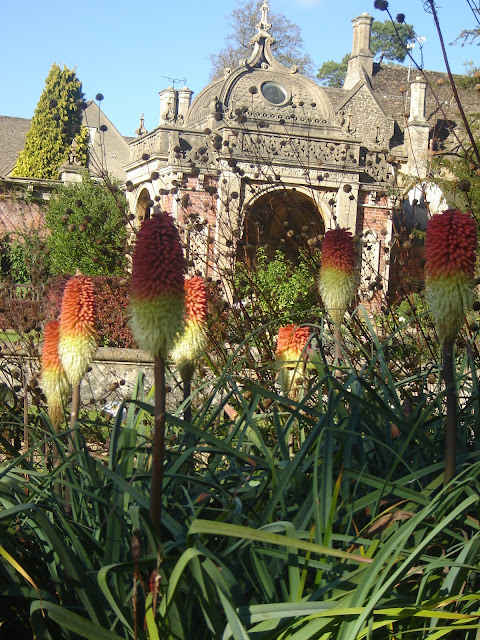 |
| The Italianate Garden at Westonbirt House |
 |
| Sapperton Canal Tunnel |
 |
| Stone marking the source of the Thames River |
 |
| My friend Clive inside the Roman Amphitheatre at Cirencester |
 |
| The beach at Westward Ho! |
 |
| Hiking on the SWCP, heading to Clovelly |
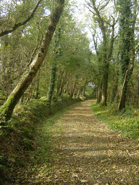 |
| The Hobby Drive, the SWCP as one approaches Clovelly |
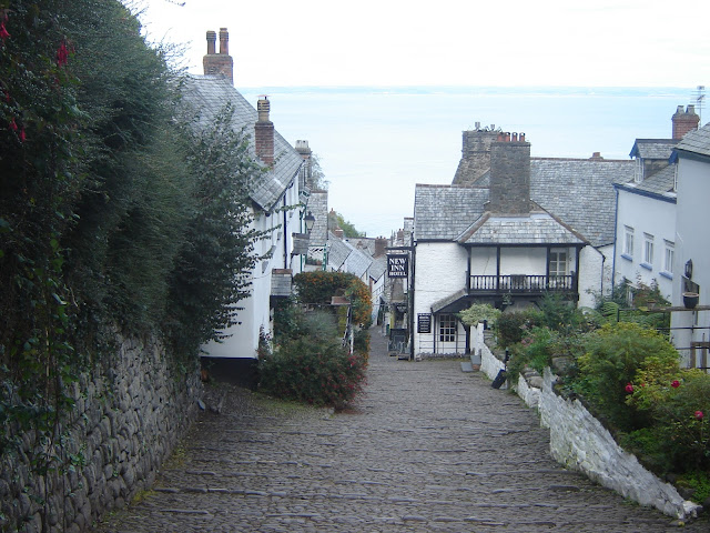 |
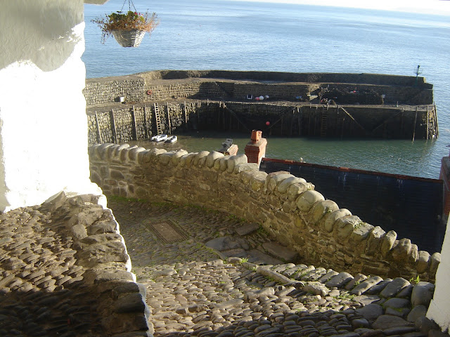
| The top of High Street in Clovelly, and the New Inn Hotel where I stayed for 3 nights |
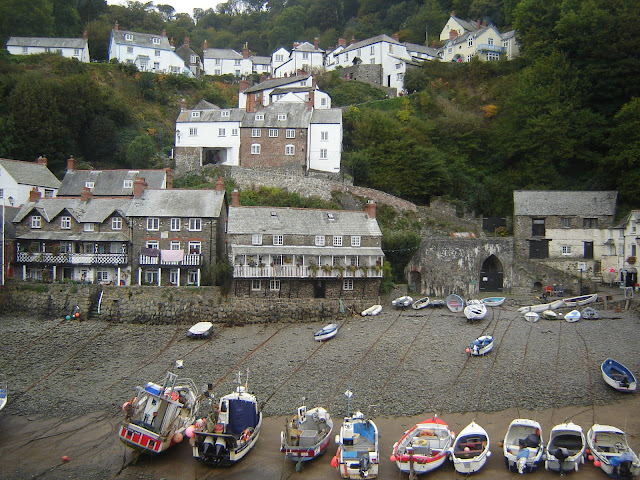 |
| Clovelly Harbor at low tide |
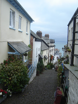 |
| High Street in the lovely village of Clovelly |
 |
| The street leading to Clovelly Harbor |
 |
| Clovelly Harbor at high tide |
 |
| The Angel Wings bench on the SWCP on the Clovelly Court Estate |
 |
| Detail on the Angel Wings bench |
 |
| The SWCP near Hartland Point |
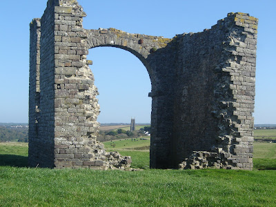 |
| Ruined tower, originally built as a folly, framing the 14th Cent. St. Nectans Church, with the highest church tower in Devon |
 |
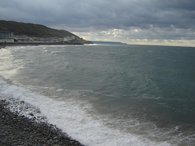
| The Devon coast South of Hartland Quay |
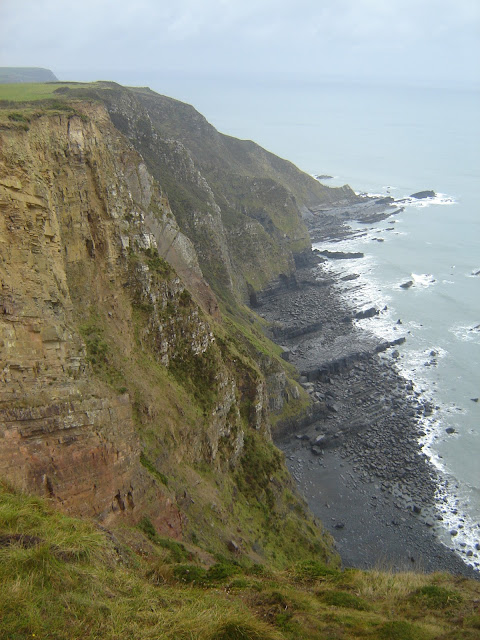 |
| The dramatic coast along the SWCP |
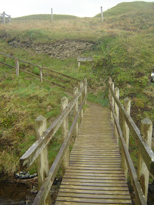 |
| The wooden bridge you cross as you leave Devon and enter Cornwall |
 |
| The coast of Devon, looking back to where I just hiked from |
 |
| The beach and canal at Bude |
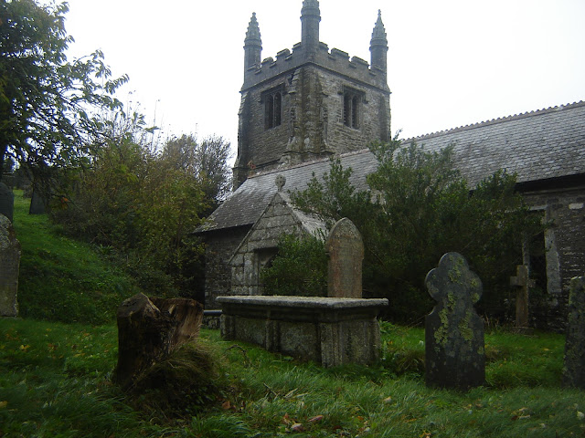 |
| St. Genny's Church, near Crackington Haven |
 |
| Highcliffe, the tallest area of coast in Cornwall |
 |
| Steps ascending a hillside on the SWCP [there were 195 steps -- I counted them!] |
 |
| The attractive harbor at Boscastle |
 |
| There were many stiles to cross on the path -- this was an unusual stone stile. |
 |
| The Cornish coast, approaching Tintagel |
 |
| Are these the castle ruins of the legendary King Arthur in Tintagel? |
 |
| Tintagel Post Office, dated to 1380, a rare surviving example of a Cornish hall-house |
 |
| The Cornish coast near Trebarwith Strand |
 |
| The lovely coastal village of Port Isaac, with "Doc Martin's" house in the middle |
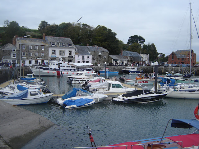 |
| Padstow harbotr |
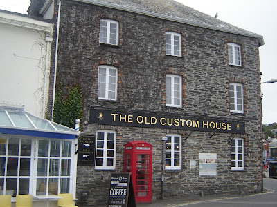 |
| The Old Custom House in Padstow, one of the town's premier buildings, where I spent the last night of my hike |


